Final Day in Glacier Park

Today we begin at the end of the day’s journey. We left St. Mary for Many Glacier, and after a nice hike around Swiftcurrent Lake, we had lunch and drove into Canada. Our destination was Waterton Lake Park, one of the earliest Canadian National Parks. It is adjacent to and really, part of Glacier Park.

In fact, in 1932, the US and Canada created the world’s first International Peace Park: joining together Glacier National Park and Waterton Lakes National Park as the Waterton-Glacier International Peace Park. It was the first Peace Park, and today there are 170 of them. UNESCO designated the Waterton-Glacier International Peace Park as a World Heritage Site in 1995.

Waterton lives for the summer season. Its population is less than 90 people, and in the winter, the full-time population drops below 48 people.

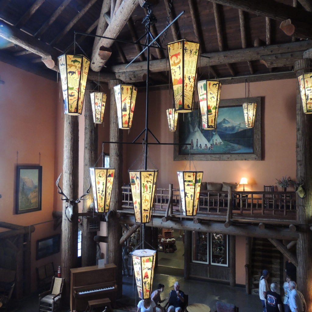
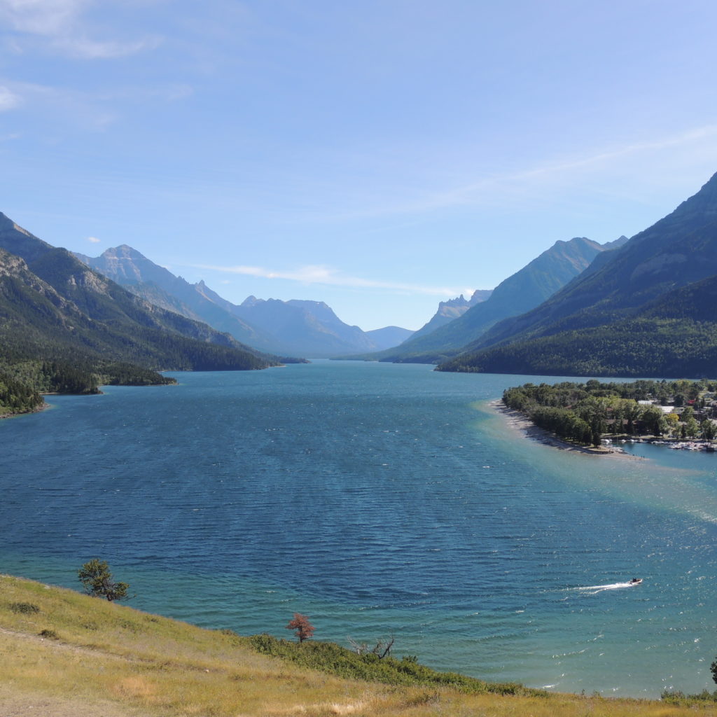
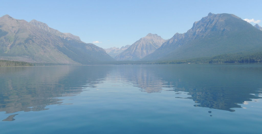
We are staying at the Prince of Wales (POW) hotel. It was built in 1927. It is another of the Great Northern Railway hotels, a chalet-style place, without air conditioning, and which only recently added wifi. There are no TVs in the room. OTOH, you stay at the POW for the view, and here is the view from our room:

DSCN5516

Wrongo is looking out the window at that spectacular scene right now, and it is a fitting capstone to our time in Glacier. The day started in St. Mary, Montana. It rained quite hard yesterday, and while the temperature in town was in the mid-50s, down from the low 80s the day before, snow fell on the mountains around St. Mary. Here is a photo taken at twilight last night:

DSCN5460

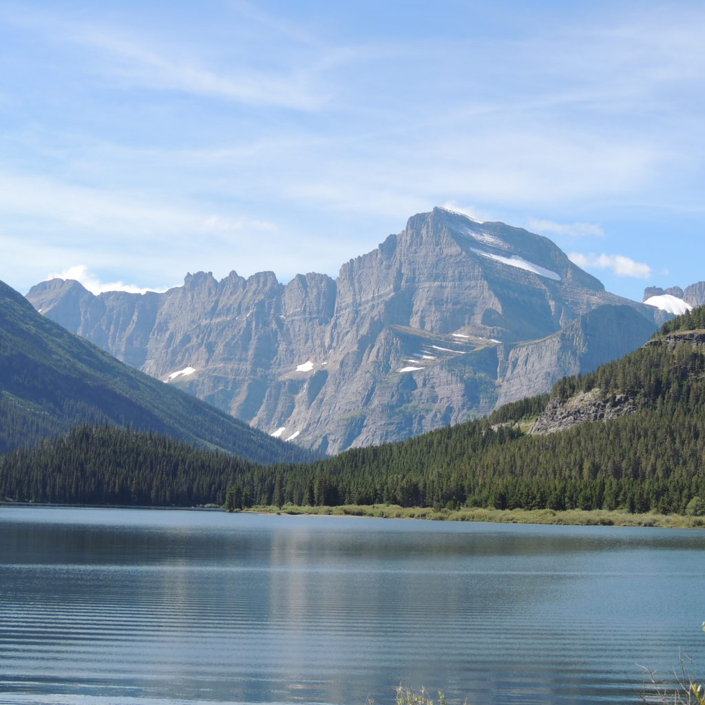
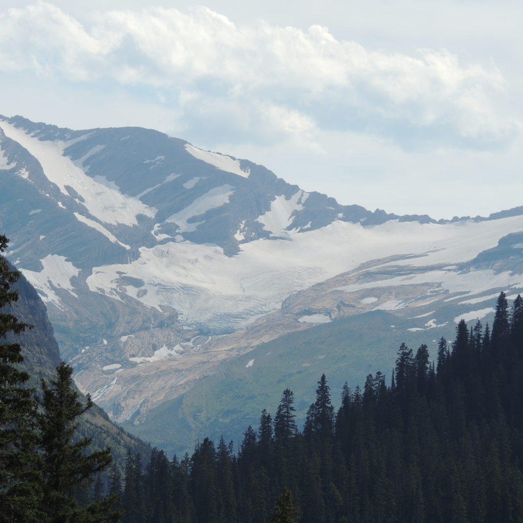
We spent the morning at Many Glacier, an area within Glacier National Park located north of the Going-to-the-Sun Road, on the east side of the park. The Many Glacier Hotel, was also built by the Great Northern Railroad in 1915, and it fronts on Swiftcurrent Lake. The hotel sits in a bowl of mountains, the most significant of which is Mount Grinnell. Back in the day, people hiked the 12 mile round trip to view Grinnell Glacier, one of the most frequently photographed glaciers in the park. This means that there is a very well documented historical record of Grinnell’s glacier shrinking over the 176 years since the end of the little ice age in 1850. Grinnell is one of the many in Glacier NP that are likely to be gone by 2030.

Here are a few photos of the Swiftcurrent Lake area that were shot this morning. Here is the Lake with Mount Grinnell on the right:

DSCN5464

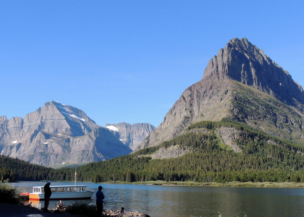
Finally, here is a shot across Swiftcurrent Lake. Mount Grinnell is to the left in this picture, and we are looking at a part of the Garden Wall that makes up the Continental Divide as we discussed yesterday:

DSCN5504

There was wildlife in abundance at Many Glacier. We saw bear scat while hiking around the lake, and later a couple traveling with us, saw a Grizzly Bear in the lake. There were Mountain Goats and Bighorn Sheep visible grazing on the slopes above us, and on the drive from Many Glacier to Waterton, we stopped to watch a Black Bear devouring berries, and for the ten minutes or so that we watched, the bear was totally oblivious to humans at the side of the road.

Tip: If you plan to cross into Canada, take Route 17 (Chief Mountain Highway). It is only open from May to September, at Chief Mountain Crossing. It had no traffic when we passed through.

Sources:

http://www.pc.gc.ca/eng/pn-np/ab/waterton/natcul/inter.aspx

http://www.glacierparkinc.com/lodging/prince-of-wales-hotel/information-and-policies/

http://www.albertasouthwest.com/waterton_lakes_national_park_community

https://en.wikipedia.org/wiki/Grinnell_Glacier

https://en.wikipedia.org/wiki/Little_Ice_Age

https://en.wikipedia.org/wiki/Chief_Mountain_Border_Crossing

Facebooklinkedinrss

Glacier Park: Days Two and Three

We spent Wednesday traveling the Going to the Sun Road (GTTSR) across Glacier National Park from West to East. The weather was perfect for the 50 mile trip, which we took in one of the red, “Jammer” coaches. Below is a photo taken at Logan Pass, a place to view the Continental Divide, or what the park rangers call the “Garden Wall”. The Garden Wall was formed by glaciers scouring both sides, making it a knife-edge like series of mountains. The Blackfeet called the Continental Divide the “Backbone of the World”:

DSCN5353

The horizontal white line on the photo above is the GTTSR coming from the West Glacier area.

Only 25 glaciers remain in Glacier National Park, down from 150 in the 1850’s, which was at the end of the so-called Little Ice Age that predated the start of the industrial revolution. Here is a photo of one of the most accessible remaining in the park, Jackson Glacier:

DSCN5410

If you want to witness one of the last glaciers, this one is easy to view, and as they say, it’s going, going, gone for Jackson Glacier, maybe in the next five years.

Towards the end of our trip on the GTTSR road, we moved from above the tree line to a “Parkland” forest at about 4500’, Upper St. Mary Lake, on the East side of the Continental Divide. It is almost 10 miles long. Here is a view of Upper St. Mary Lake, looking up the lake at the steep mountains that surround it:

DSCN5430

The little island visible in the photo is Wild Goose Island. This is considered to be the most iconic view of Glacier Park. Triple Divide peak is on the left. It is one of a few spots where water can flow in three different directions, to the Pacific Ocean, the Atlantic Ocean, and to Hudson Bay and the Arctic Ocean. The area was scarred by a forest fire in 2015, so while evidence of the fire is very apparent, so are the many wild flowers that grew in the fire’s wake.

No story about Glacier Park would be complete without a discussion of the Blackfeet Indians. The Blackfeet owned the land that became Glacier. In 1895, representatives of the US and Blackfoot leaders met to discuss the purchase, but the Blackfoot were reluctant to sell.

After pressure, the leaders agreed to the sale for $1.3 million.

Glacier Park was created because the Great Northern Railway wanted a destination venue for their railroad. The park provided a tourist destination; the Great Northern provided the transportation and also owned the hotels adjacent to the park. Great Northern promoted the park as an “Indian” destination and referred to the Blackfeet as “Glacier Park Indians.”

Great Northern arranged for these thespian Indians to meet tourists as they got off the train, and tipis were installed near the park lodges. Thursday’s visit by Wrongo and Ms. Right to East Glacier, home of the Glacier Park Lodge, confirmed that the tipis are still onsite.  Glacier National Park Lodge was the brainchild of Louis W Hill, son of the railway’s founder, James J Hill. The lodge is listed on the National Register of Historic Places. Here is a photo of the iconic great hall of the lodge:

DSCN5453

As a part of its Glacier National Park promotion, the Great Northern Railway in 1915 produced a movie entitled A Day in the Life of a Glacier Park Indian.

If you ever get to East Glacier, make time to visit the Museum of the Plains Indian in Browning Montana; it is well worth your time. Browning is located on the Blackfoot Reservation, and is the capital city of the reservation. If Gregg is there, you will hear a straight forward talk about how the Europeans won the land grab war with many different Indian tribes, and how the Blackfeet have been on their ancestral lands for 10,000 years.

In a sad commentary, Browning is considering bankruptcy


Facebooklinkedinrss

Glacier NP Musings

We stayed in Whitefish Montana for the first two days of the trip. It would be difficult to come up with a town that feels so welcoming and comfortable for tourists. It is a small place, with about 7,500 residents.

The town lives on tourists, with some 800,000 visiting this year in July alone. Anyway, notably nice people, and great food is on offer in the restaurants. We ate at the Tupelo Grille, and at 48° Latitude, both were fabulous. We spent today in the Lake McDonald area of the Park. We took a few pics.

First, on a hike on Beehive Mountain, we walked through an area that had burned in 2003, when 57,000+ acres went up after high school kids failed to put out their campfire. After the fire, plants and flowers grew in profusion. Here is a photo of fireweed, which only grows after the fire is out:

DSCN5149

We moved on to Lake McDonald. There is a fire near Missoula, some 137 miles away that had smoke drifting over the lake. So our photos were hazy, but here is a photo Wrongo took from a small boat:

DSCN5185
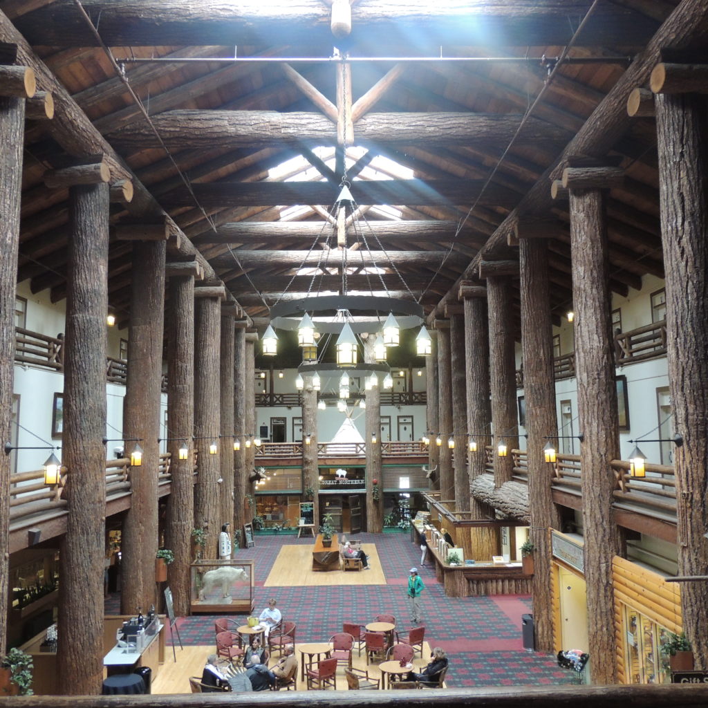
Finally, we spent time at the Lake McDonald Lodge. It is run by Xanterra, who also have properties at the Grand Canyon, Zion, Yellowstone, Crater Lake and many other National Parks. The Lodge is an old property, built in 1913, and it’s located in a wonderful spot. We were struck by the huge chandelier in the lobby:

DSCN5205

The chandelier was designed by members of the Blackfeet Indian tribe almost 100 years ago. Here is a detail photo Wrongo took on Tuesday:

DSCN5201

You know Wrongo has to close with a political comment. Montana was the first state to send a woman to Congress. Jeannette Rankin was elected to the House in 1916, four years before women won the right to vote after the ratification of the 19th Amendment in 1920. She was a Republican and the only Congressperson to vote against the US entering both WWI and WWII.

Glacier Park had its 100th Anniversary in 2010. Visit it soon if you expect to see glaciers. They are forecasted to be gone by 2030.

Facebooklinkedinrss